Enjoy traveling, and share a video version of Organic Maps Anthem! With your donations and support, one day everyone can seamlessly switch from Google or Apple Maps to a better open-source and privacy-friendly alternative. https://organicmaps.app/donate/
This one came up yesterday, while preparing for @organicmaps GSoC student work.
When developing an editor, you need to work with OSM Sandbox, a dev copy of API with no data. Sometimes it's frustrating because complex data is where an editor breaks. Usually I downloaded an OSM extract in JOSM, fixed ids, and uploaded it to the Sandbox, but on the 100th time I gave up.
This script helps you transfer a bbox worth of data in two commands, one of which is pip install.
This one came up yesterday, while preparing for @organicmaps GSoC student work.
When developing an editor, you need to work with OSM Sandbox, a dev copy of API with no data. Sometimes it's frustrating because complex data is where an editor breaks. Usually I downloaded an OSM extract in JOSM, fixed ids, and uploaded it to the Sandbox, but on the 100th time I gave up.
No tracking! No crapware! No pesticides! Organic Maps, where freedom resides! Navigate with privacy, feel the vibe, Community-driven, let's take the ride.
No tracking! No crapware! No pesticides! Organic Maps, where freedom resides! Navigate with privacy, feel the vibe, Community-driven, let's take the ride.
One of our users has generated a song about Organic Maps. How does it sound to you? 😀
Beneath the twinkling stars, I stroll hand in hand, With Organic Maps, exploring enchanted lands. From Eiffel's gentle glow to Iceland's black sand shore, Every step a melody, every sight, pure amore.
Fun fact about @organicmaps? It can do public transport navigation with the Beijing Subway, that Google Maps can't.
The time are still very off compared to local mapping apps, but it does work and if you don't care much about having exact times for arrival, it is worth using.
Oh and if you need to buy tickets, just point people to the name of the subway station on the map, they'll manage :)
@governa I do especially like @organicmaps as my backup mapping application, both for work and the side job. Both often involve going where there's little or no cell signal, so the ability to pre-download sections of map is HUGE. With the current #openstreetmap limitations in my area, it can't always get the fastest route, but so far always gets me there. Plus, it motivates me to get back into #osm to update the #maps and stay active.
Super glad I stumbled upon @organicmaps and gave it a try! Not only does it do exactly what I needed, but I found the UI to be much simpler than Google Maps. Plus, open source, no ads, offline usage *and* privacy friendly? You got a lifetime user in me y'all 😂
Let us announce the March/April release with updated European elevation data, and welcome new contributors! Read the detailed announcement on our website:
My question is when you think it will be available the transports maps to use like on #googlemaps ? Since is the only why a lot of people, most of them, are not using #OrganicMaps 🙂
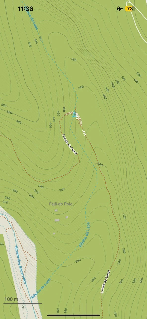
@organicmaps great news! I use a lot OM for hiking in Spain, and better isolines is a great improvement.
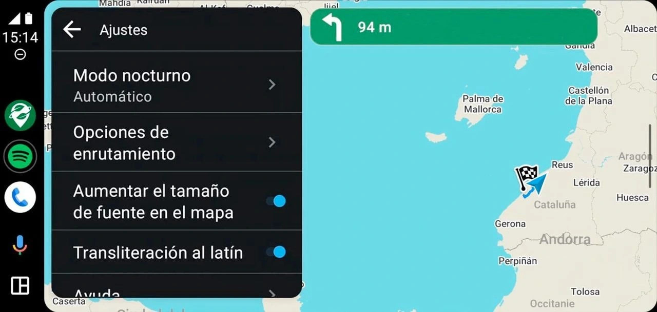
Wrt AndroidAuto: I've tried to use it with OM Feb/March, but OM does not show up in the AndroidAuto apps when I connect my phone to the car. Does it need to be enable somehow?
@organicmaps great news, and I've already submitted some links to opendata DEM for Bulgaria.
I was wondering though, my cartography study books indicate that the digits on the isolines are to be always oriented uphill, especially in cases like @organicmaps where there's no hillshading or any way to figure out the direction of the slope. Maybe an enhancement for a future version?
Here's an example where the digits are upside down in the screenshot from your post:
Interested in seeing public transport, satellite imagery, track recording, or some other features in Organic Maps? We are open for Google Summer of Code 2024 proposals from motivated contributors/students, read more here: https://github.com/organicmaps/organicmaps/wiki/GSoC-2024-ideas
Now everyone can back up or share all bookmarks and imported tracks as one KMZ file with just one click! And then import everything back from the same file.
Apple users can now edit the colors of imported tracks and have a more convenient way of editing bookmarks. And don't forget to check our updated About dialog!
@organicmaps - Google has recently introduced a feature to share saved places (for editing and for viewing), do you have plans or is there a possibility to import them in Organic Maps?
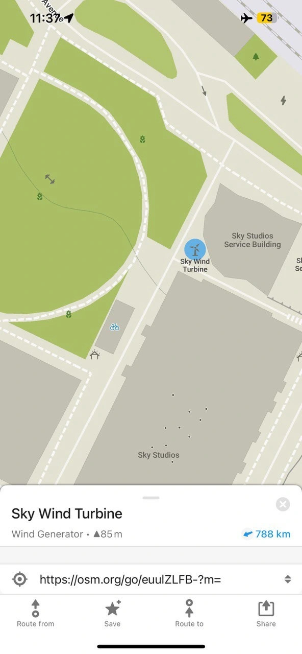
@organicmaps Hmm. I tried looking for map legend in the app and on the site. I can't seem to find an overview? (For instance I have some pink routes near me and wonder what those are meant to be)


@organicmaps You guys are awesome!
@organicmaps
Organicmaps is just so damn smooth!
It is a shame that OSMAnd+ is so slow and bad at loading, and has a clunky UI.
OrganicMaps has way too little features for me, like custom routing, more infos, etc.