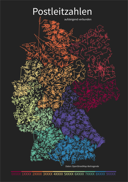
#30daymapchallenge Day 2 (Lines): Sequential postcodes of Germany, making use of the unpopular 🌈 rainbow color map. This map was inspired by Kate, aka @pokateo_maps on the bird site.
|
10 comments
@koriander I would like to print this. Do you have a high resolution version of this map? @ubahnverleih Cool! I've been thinking about how to document this challenge and decided to use it as an opportunity to practice some basic webpage creation. This will likely result in a volatile page, but the following link should keep working: https://bru.berlin/30dmc/ Go to day 2 (Lines) to find a link to the SVG file for printing in any size and let me know how it turned out 🙃 @djh @koriander next stage: Germany should just go from 16 to 10 states based on starting digit of PLZ? 😂 @koriander Anybody else see a head facing left, light green mouth, yellow nose/eye, reddish hair, somewhat punk style? |


I used the QuickOSM plugin in QGIS to get the postcode boundaries from OpenStreetMap, because I only realized now that govdata.de has the dataset I needed for this. I then calculated centroids and wrote a python script to connect adjacent postcode numbers with lines. There are lots of unused codes and a few gaps, so you're only seeing 8.218 lines.